


chemin des lépreux

mjl12740
User
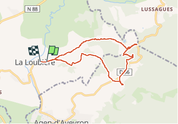

Length
8.3 km

Max alt
700 m

Uphill gradient
182 m
Km-Effort
10.8 km

Min alt
567 m

Downhill gradient
195 m
Boucle
Yes
Creation date :
2022-08-28 05:57:24.716
Updated on :
2022-08-28 08:28:08.554
2h29
Difficulty : Very easy

FREE GPS app for hiking
 SityTrail
IGN / Geographical institutes
SityTrail Plus
The world is yours!
About
Trail Walking of 8.3 km to be discovered at Occitania, Aveyron, La Loubière. This trail is proposed by mjl12740.
Positioning
Country:
France
Region :
Occitania
Department/Province :
Aveyron
Municipality :
La Loubière
Location:
Unknown
Start:(Dec)
Start:(UTM)
473837 ; 4913161 (31T) N.
Comments